Ever wondered what might be hidden under the ground you are walking on? The inhabitants of the village Rudice know exactly - a great underground system of caves. To be exact, the second-longest in the Czech Republic. Come and explore with us the Rudice area, which is located just around 30 km outside of Brno.
What not to miss here
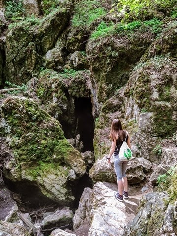 After you get off at the bus stop Jedovnice-Pila, the journey following the sound of the underground starts. Your first stop is located just around 750 m from the stop - Rudice Underground stream entrance (Rudické Propadání).
The natural monument Rudické propadání is a part of the Moravian Karst Protected Landscape Area. The Jedovnice stream sinks into a 90 m deep and over 12 km long cave system, the second-longest in the Czech Republic. It also includes the largest underground waterfall in the Czech Republic (35 m), the deepest dry abyss (153 m) and the Giant Dome.
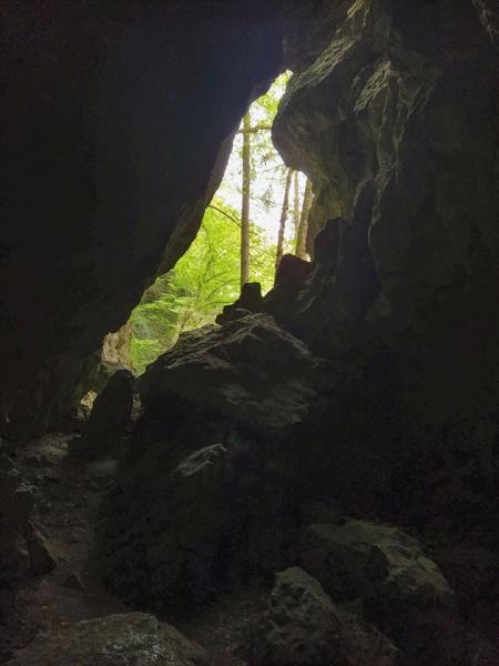 Right next to the spot where the stream disappears into the unknown underground accompanied by an overwhelming echo of water splattering onto the rocks, there is a freely accessible cave with a large dome with two entrances. One leads over a footbridge over the Jedovnice stream, the other, quite impassable, leads to the waterfall's sinkhole.
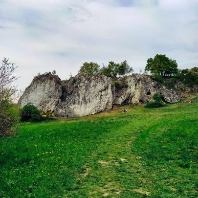 Continuing our walk with the next stop, a limestone rock town Kolíbky is not far away. Kolíbky is a very popular destination for climbers in the Moravian Karst. Fifteen metres of high rocks provide many opportunities for climbing. This place is an archaeological site, as the site was inhabited in Magdalenian culture by horse and reindeer hunters, who left not only the skeletal remains of hunted animals but also stone tools and other remains pointing to the inhabited area. Also here you can find various smaller accessible caves and even a cave "window".
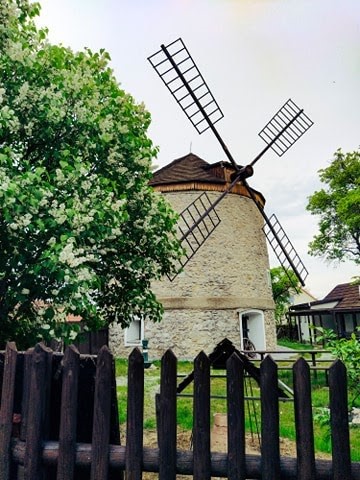
In Rudice they also boast a stylishly renovated windmill from the 19th century, which today serves as a museum with several exhibits. The museum can amaze lovers of beautiful crystalline forms of colourful varieties of quartz. There is a unique collection of Rudice geodes, which was collected by a local. A large part of the exhibition deals with the history of ironworks in Rudice and its surroundings, and a part is dedicated to speleology, whose roots are closely connected with this area.
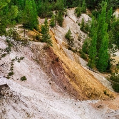
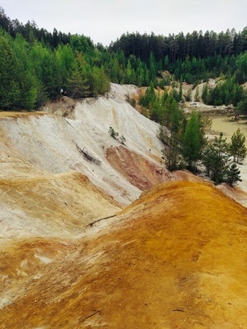
Last but not least stop on our walk is the Rudice quarry (Lom Seč). The quarry lies on the outskirts of the village Rudice. The site is part of the Rudice Plateau and represents one of the largest outcrops of Jurassic to Lower Cretaceous sediments, which are referred to as the Rudice strata. These consist of quartz sands, variegated clays and black-brown ferrous sands and sandstones. These coloured sands create unique scenery along with water by which the quarry is partially flooded.
How to get there
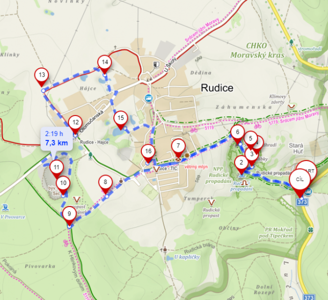 To get to the Rudice area, you will need to take the bus 201 leaving from the bus stop Stará Osada in the direction Jedovnice. The ride takes approximately thirty-five minutes to your final stop called Jedovnice-Pila. From this same bus stop, you will also go back to Brno. The bus ticket is bought at the driver and costs 27 CZK one way if you have a valid Brno transportation card (without the card the price is around 120 CZK one way). The overall hike has about 10 kilometres but can be shortened if you leave out the lakes marked 12-15 on the map. Mark 16 is a local pub/restaurant where you can get some refreshment (both drinks and food).
In order not to get lost us the prepared map of the hiking trail.
So don't forget your mask and enjoy the lovely weather!